
Fractals and Euclidean Geometry in Pre-colonial African Architecture: A New Perspective

Fractals occupy a prominent place in African geometry and architecture, but they represent only one of several forms of mathematical ordering reflected in African settlement patterns.
In his influential book ‘African Fractals: Modern Computing and Indigenous Design’ (1999), the mathematician Ron Eglash argues that African fractal patterns, visible in its architecture and artistic traditions, are produced through conscious acts of abstraction.
They are derived from pre-existing systems of knowledge and aesthetics, including recursive loops, concepts of infinity, and self-organizing systems.
While the terms used to describe fractal patterns (which are recursive, scalable, self-similar, and contain an infinite length within a finite boundary) often lie in mathematics and semiotics from nature, the settlement patterns in Africa, which are a precursor to these terminologies, are drawn from cultural practices and societal norms.
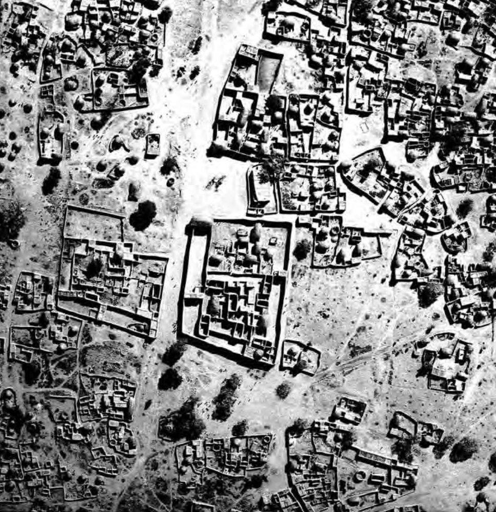
In his ethnographic survey of Logone-Birni (in Northern Cameroon), Eglash observes that the old town comprises huge rectangular building complexes, the largest of which was the royal palace. Each complex is created by a process called “architecture by accretion,” whereby new rectangular enclosures are added to old rectangles, which thus grow larger as you move outward from the center.
The result of this scaling process is a series of “rectangles within rectangles within rectangles,” forming self-similar structures that are clearly visible in aerial photographs of the old town.
Eglash also identifies this rectangular fractal design in the artistic motifs and passages in the palace of the Miarre (chief/sultan).
The central motif of the guti shows a rectangle inside a rectangle inside a rectangle. Similarly, the passage leading to the throne room of the Miarre follows a rectangular spiral that requires visitors to observe increasingly formal behaviour as they proceed deeper into the palace.1
‘Vue aérienne de Logone-Birni’, c. 1936. Quai Branly.
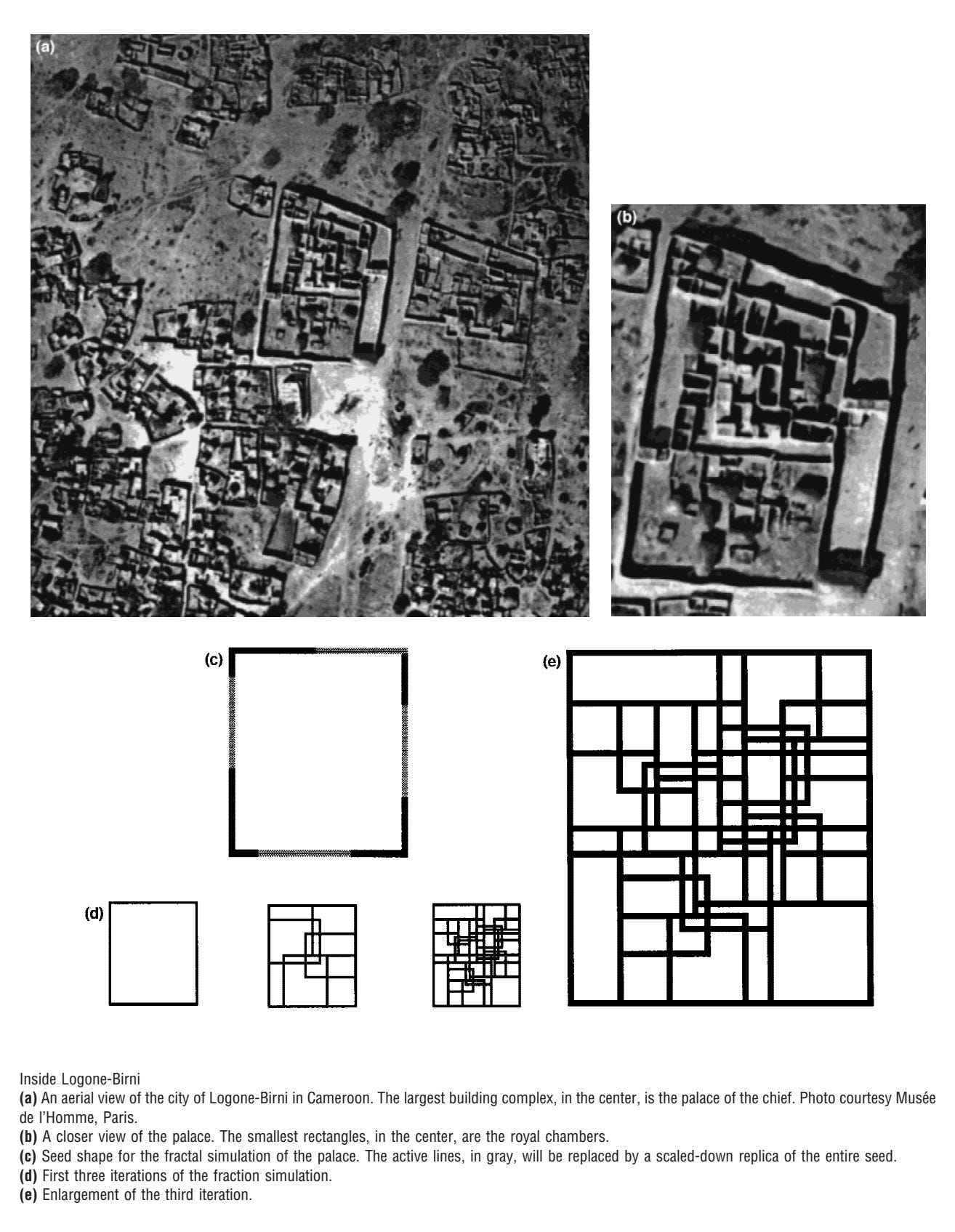
Inside Logone Birni. images by R. Eglash.
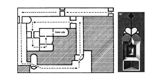
The spiral path taken by visitors to the throne. drawing by Lebuff (1969). The guti, the royal insignia, painted on the palace walls. images by R. Eglash.
The fractal geometry of Logone’s architecture, with its pattern of “rectangles within rectangles within rectangles,” is comparable to the settlement layouts found in several other African societies, from the Ba-Ila of southern Zambia to the Songhai of Lahitanga in Mal
In the case of Ba-ila and Lahhetanga, the settlements are instead characterized by a dense “circular arrangement of circles” or “ring within rings”, from the large enclosing outer wall, to the curvilinear cluster of homesteads and kraals, to individual circular huts and granaries, down to the circular fireplace and pottery.
Additionally, the streets and paths of several African settlements, from Mlomp in Senegal to Cairo in Egypt, branch into progressively smaller networks that resemble the fractal venation patterns of a leaf.2
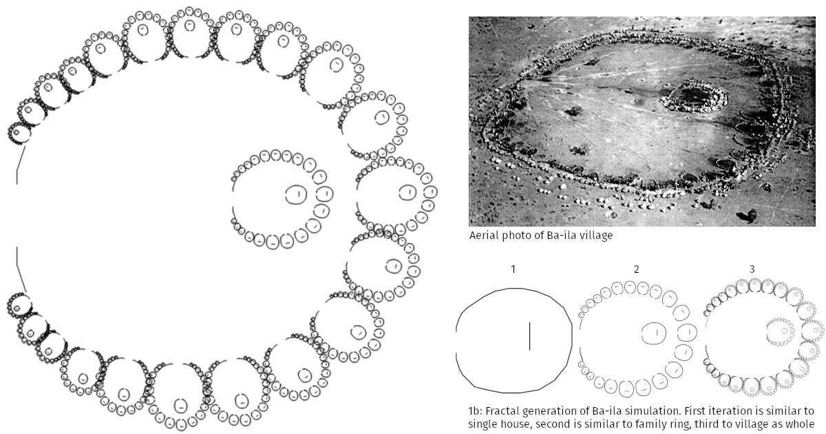
Fractal geometry of a Ba-Ila village in Southern Zambia. Images by R. Eglash.
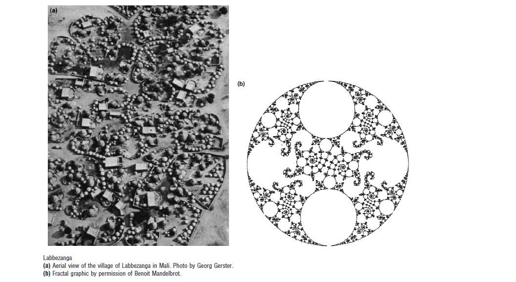
Labbezanga in Mali. Images by R. Eglash. Note that the rectangular buildings were originally circular
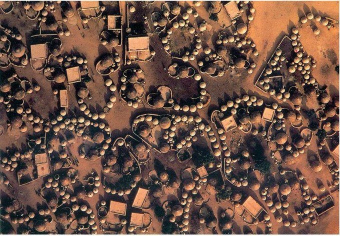
Labbezanga, Mali.
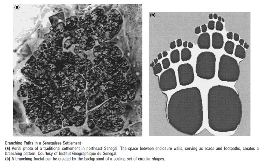
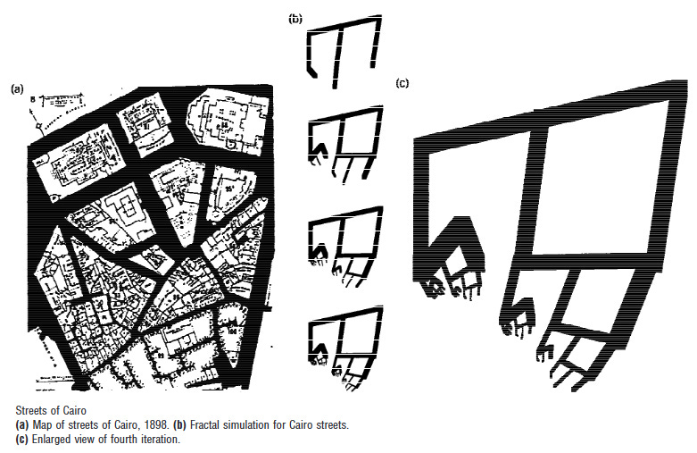
Branching paths in Mlomp, Senegal, and Cairo, Egypt. Images by R. Eglash.
He observes that African fractals weren’t simply a product of social organization (Logone-Birni was a hierarchical society), nor were they exclusive to the continent, as comparable patterns can be found in various forms in southern India.
Additionally, he points out that fractals were largely absent in indigenous societies of pre-Colombian America, some of whose settlements display more symmetrical Euclidean layouts, including quadrilateral grids and concentric circles composed of finite linear layers radiating from a single centre.3
However, Eglash was aware of the tendency among many Western social scientists to essentialize African societies, as well as the structuralist nature of most anthropological research on African cultures and traditions.
He was also familiar with the philosophical critiques of African and European comparative sociology advanced by Valentin-Yves Mudimbe and Kwame Anthony Appiah.4
He therefore placed far less emphasis on the relationship between fractal architecture and pre-colonial African political systems than some popular misinterpretations of his work have suggested.
He, in fact, states early in his work that “not all architecture in Africa is fractal—fractal geometry is not the only mathematics used in Africa—but its repeated presence among such a wide variety of shapes is quite striking.”5
This caution is borne out by the fact that none of the settlements examined in his study were among the continent’s large historical cities, many of which display Euclidean layouts characterized by quadrangular and circular symmetries.
These include grid-like town plans, featuring long, straight streets, which are common in eastern Africa, the Sahel, as well as cities such as Benin and Loango, alongside concentric-ring layouts in which streets radiate outward from a central palace, a pattern most commonly associated with West African cities.
The bulk of Africa’s historical cities display hybridized urban plans, a pattern found throughout the world and shaped by processes of organic urban sprawl, fluctuating growth, and repeated redesign over centuries.6

Reconstruction of the city of Meroë, Sudan. Image by Rebecca J Bradley
Archaeological plan of the walled upper town of Hamadab (ca. 3rd century BC – 4th century AD) showing a planned layout with main road, temple, tower house, and living quarters [Photo from the Hamadab Project].
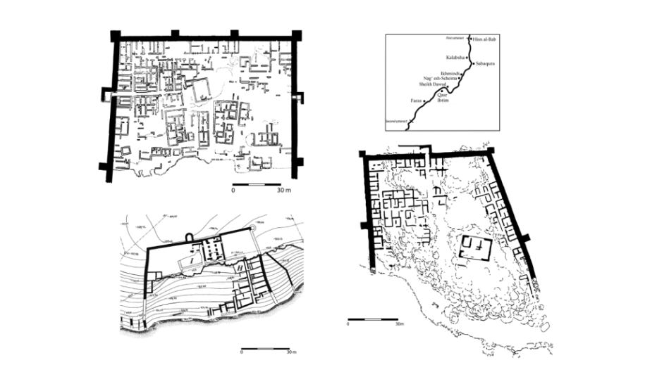
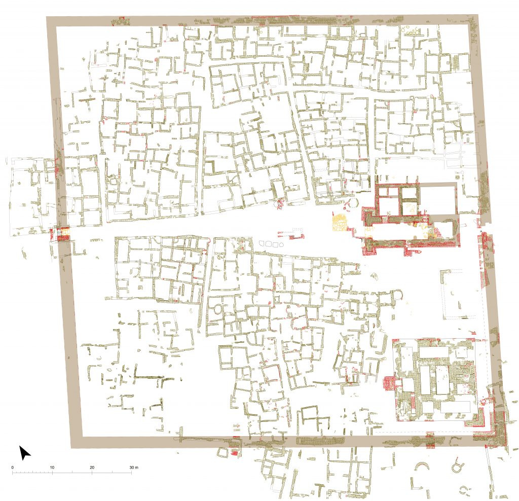
The walled towns of medieval Lower Nubia. Top left: Ikhmindi, bottom right: Sheikh Dawud, bottom left: Nagʿ esh-Scheima.7

The Swahili city of Gede, Kenya. Map by S. Pradines. At Gedi there is some evidence to suggest some kind of larger organizing principle operating in at least part of the city, that of a main central street which ran from north to south through the excavated core of the site. This street is the longest continuous route known at the site, running presumably from the North Gate, through the later inner wall, along the eastern side, and ending at the western court of the Great Mosque, where it runs into another main street running east- west. Two major streets led off at right angles from the main north-south street, one running between the north end of the house block and the Mosque of the Long Conduit, and the other running east-west along the qibla wall of the Great Mosque, possibly connecting this mosque to the Palace complex.’8
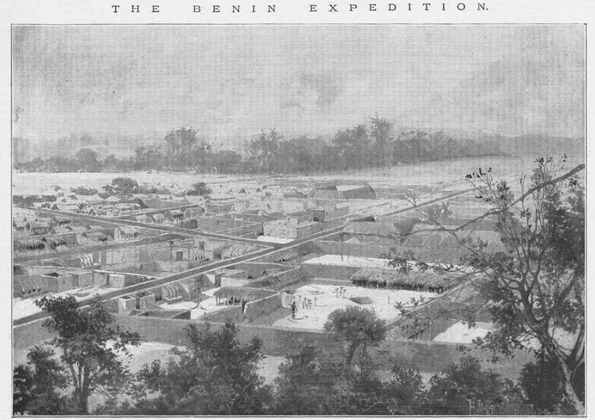
Benin City, Nigeria. c. 1897
‘View Of Coomassie, The Capital Of Ashanti.’ c. 1874. Ghana.
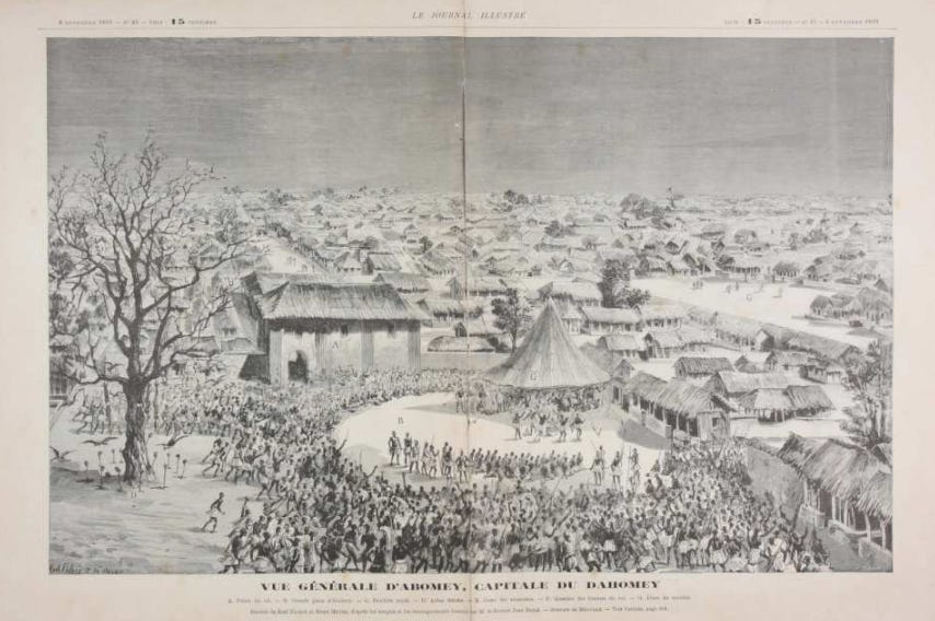
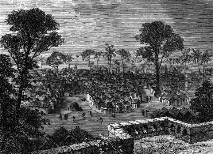
General View of Abomey, Capital of Dahomey. Benin. c. 1892. Le Journal Illustré.
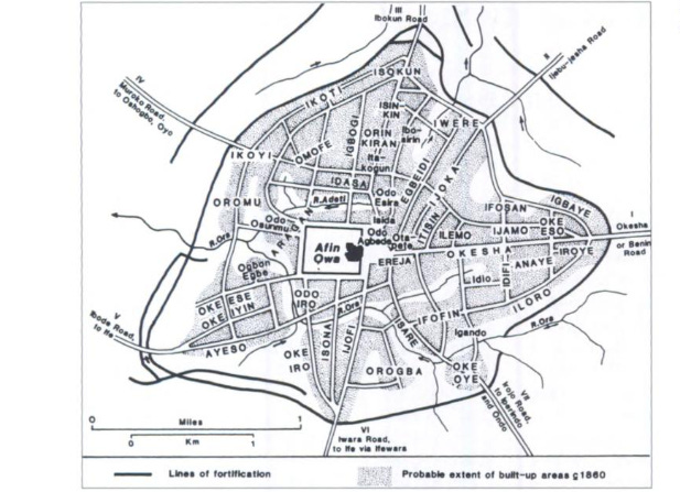
The Yoruba city of Ilesha, Nigeria, the town and its quarters, Map by J.D.Y. Peel. The palace of the Oba (King) was the locus of the town’s layout from which the town’s roads and streets radiated outwards like spokes of a wheel and continued beyond the town gates to the frontiers of the kingdom.9
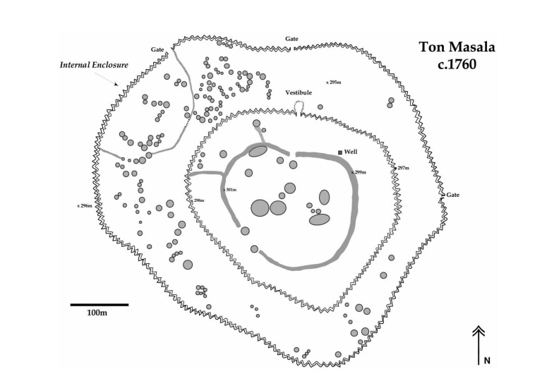
Plan of Ton Masala’s extant ruins, walls, and house foundations. Mali. Image by K. C. MacDonald10
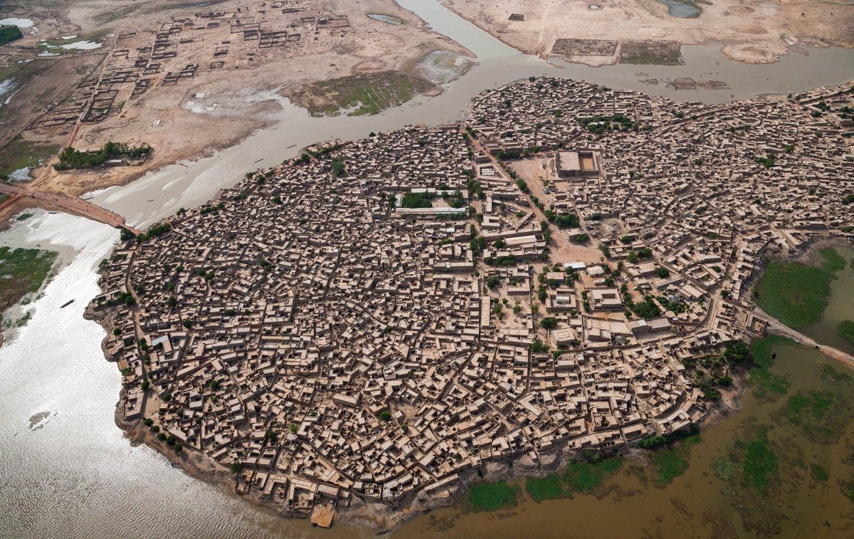
Aerial view of Jenne, Mali.
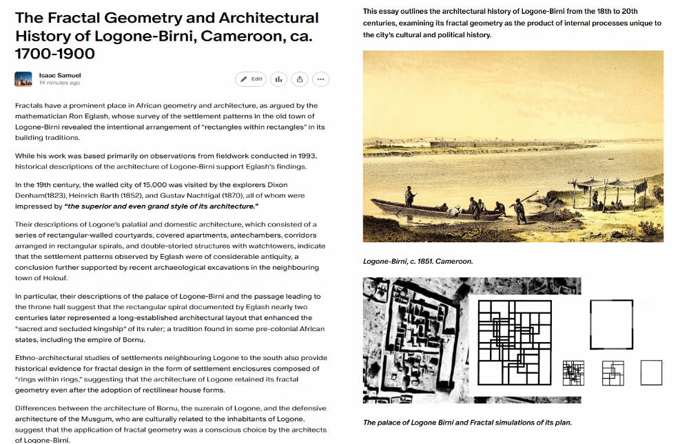
Arguably, Eglash's strongest evidence for fractal geometry in the pre-colonial period comes from the city of Longone-Birni.
While his work was mostly based on observations from his fieldwork in 1993, historical descriptions of the architecture of Logone-Birni nearly two centuries earlier support Englash’s observations.
In the 19th century, the walled city of 15,000 was visited by the explorers Dixon Denham(1823), Heinrich Barth (1852), and Gustav Nachtigal (1870), all of whom were impressed by “the superior and even grand style of its architecture.”
Their descriptions of Logone’s palatial and domestic architecture, which consisted of a series of rectangular-walled courtyards, covered apartments, antechambers, corridors arranged in rectangular spirals, and double-storied structures with watchtowers, indicate that the settlement patterns observed by Eglash were of considerable antiquity, a conclusion further supported by recent archaeological excavations in the neighbouring town of Holouf.
In particular, their descriptions of the palace of Logone-Birni and the passage leading to the throne hall suggest that the rectangular spiral documented by Eglash nearly two centuries later represented a long-established architectural layout that enhanced the “sacred and secluded kingship” of its ruler; a tradition found in some pre-colonial African states, including the empire of Bornu.
Ethno-architectural studies of settlements neighbouring Logone to the south also provide historical evidence for fractal design in the form of settlement enclosures composed of “rings within rings,” suggesting that the architecture of Logone retained its fractal geometry even after the adoption of rectilinear house forms.
Differences between the architecture of Bornu, the suzerain of Logone, and the defensive architecture of the Musgum, who are culturally related to the inhabitants of Logone, suggest that the application of fractal geometry was a conscious choice by the architects of Logone-Birni.
The Fractal geometry and the architectural history of Longone Birni from the 18th to 20th century is the subject of my latest Patreon article,
Please subscribe to read more about it here and support this newsletter:
African Fractals: Modern Computing and Indigenous Design by Ron Eglash, pg 31-38
African Fractals: Modern Computing and Indigenous Design by Ron Eglash, pg 39-48
African Fractals: Modern Computing and Indigenous Design by Ron Eglash, pg 180-182, 188-191
African Fractals: Modern Computing and Indigenous Design by Ron Eglash, pg 20
For a brief comparative history of urban settlements in Africa and Europe, see: ‘Settlement Area and Communication in African Towns and Cities’ by Roland Fletcher in ‘The Archaeology of Africa: Food, Metals and Towns’ edited by Thurstan Shaw et al
For a classic text on Europe’s transition from the more ‘organic’ town plan of the Middle ages to the revival of the Roman grid and symmetrical plans during the Renaissance, see: History of Urban Form Before the Industrial Revolution by A.E.J. Morris
For a brief critique on the ‘foreignness’ of grid-like urban planning in Africa, see: Grid Planning in the Urban Design Practices of Senegal by Liora Bigon, Eric Ross, 10-23
The forts of Hisn al-Bab and the First Cataract Frontier from the 5th to 12th centuries AD by Alison L. Gascoigne and Pamela J. Ros
At the Boundaries of Dar-al-Islam: Cities of the East African Coast in the Late Middle Ages, by Thomas Robert Gensheimer, pg 323
Religious Encounter and the Making of the Yoruba by J.D.Y. Peel, pg 31
“The least of their inhabited villages are fortified”: the walled settlements of Segou Kevin C. MacDonald